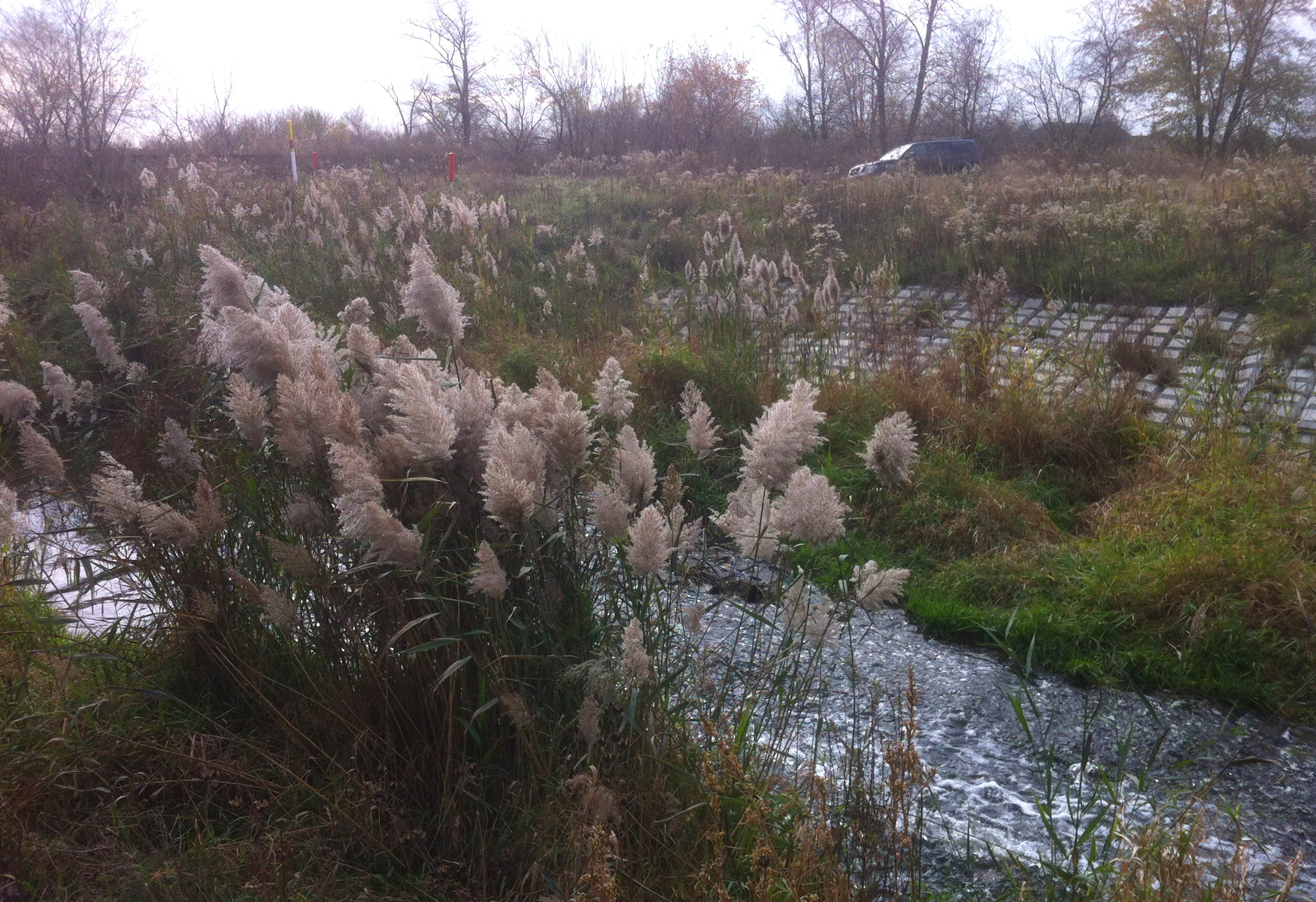
A 50-foot wide pipeline right-of-way contained an 18-inch refined product pipeline. The 18-inch pipeline crosses Dyer Ditch between a railroad corridor and a residential area in Lake County, Indiana. Downcutting of the creek bed caused the banks to become steep and unstable...
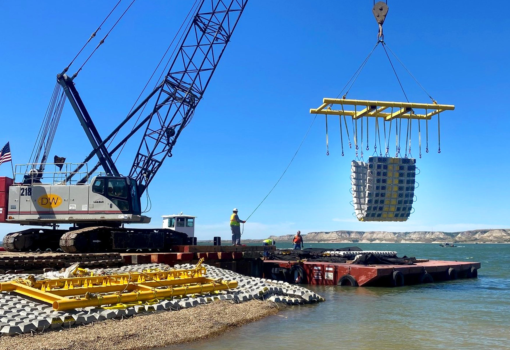
Seven pipelines crossing Lake Sakakawea in McKenzie & Williams Counties, North Dakota, experienced exposures, low depth of cover, and shoreline erosion. A multibeam bathymetry and magnetometer survey of the pipeline was completed to identify topographic features...
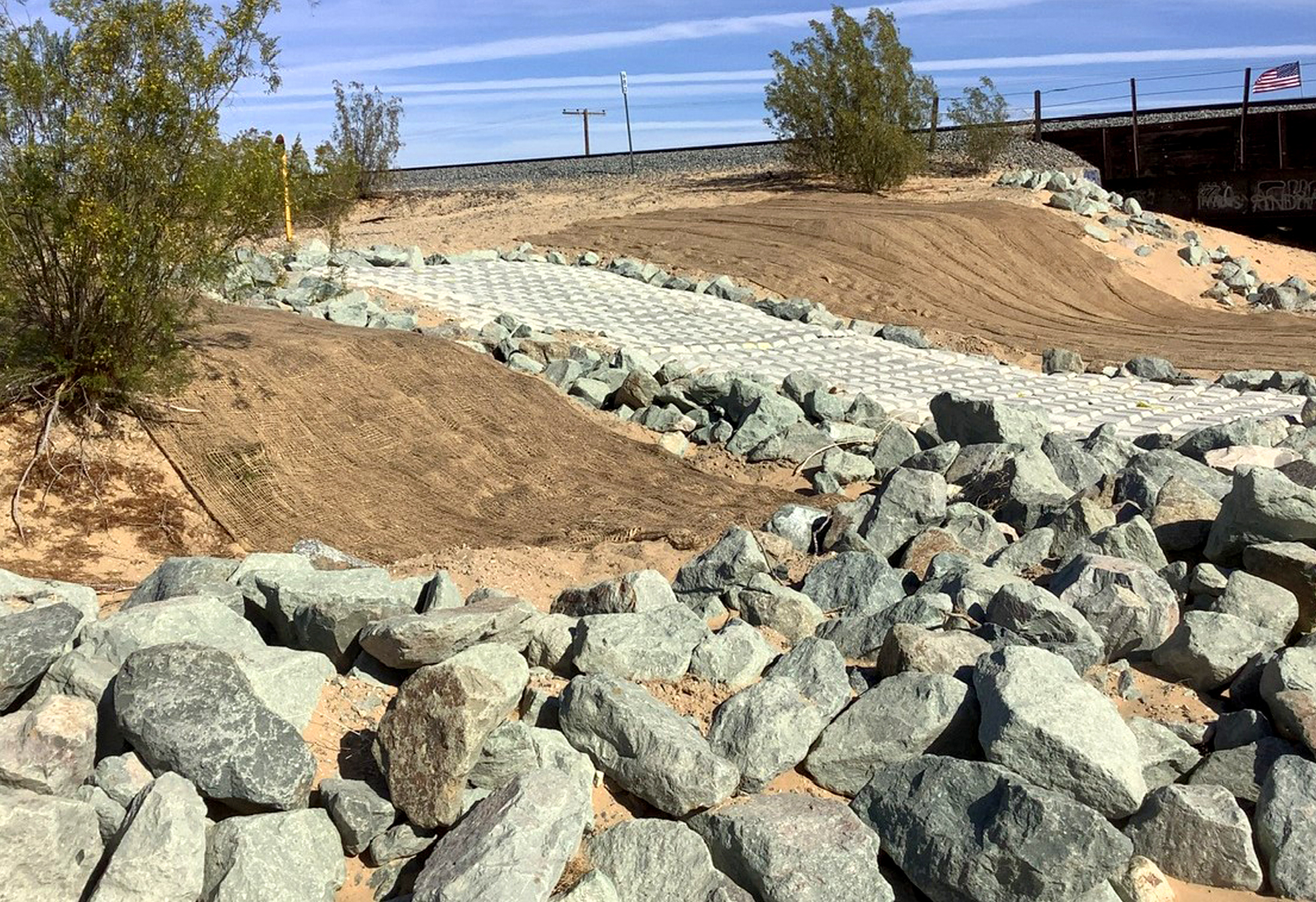
20-inch products pipeline runs parallel to a railroad track in Imperial County, California. Both the pipeline and the railroad are crossed by the 250-foot wide Mammoth Wash. Flash floods caused lateral migration and eroded 3 to 6 feet of the right-descending bank.
A 15-foot deep erosion rill had formed in an unnamed wash due to storm water flows, exposing one of four natural gas pipelines in the area. If left uncovered and unprotected, the pipeline risked further exposure and potential damage due to continued erosion.
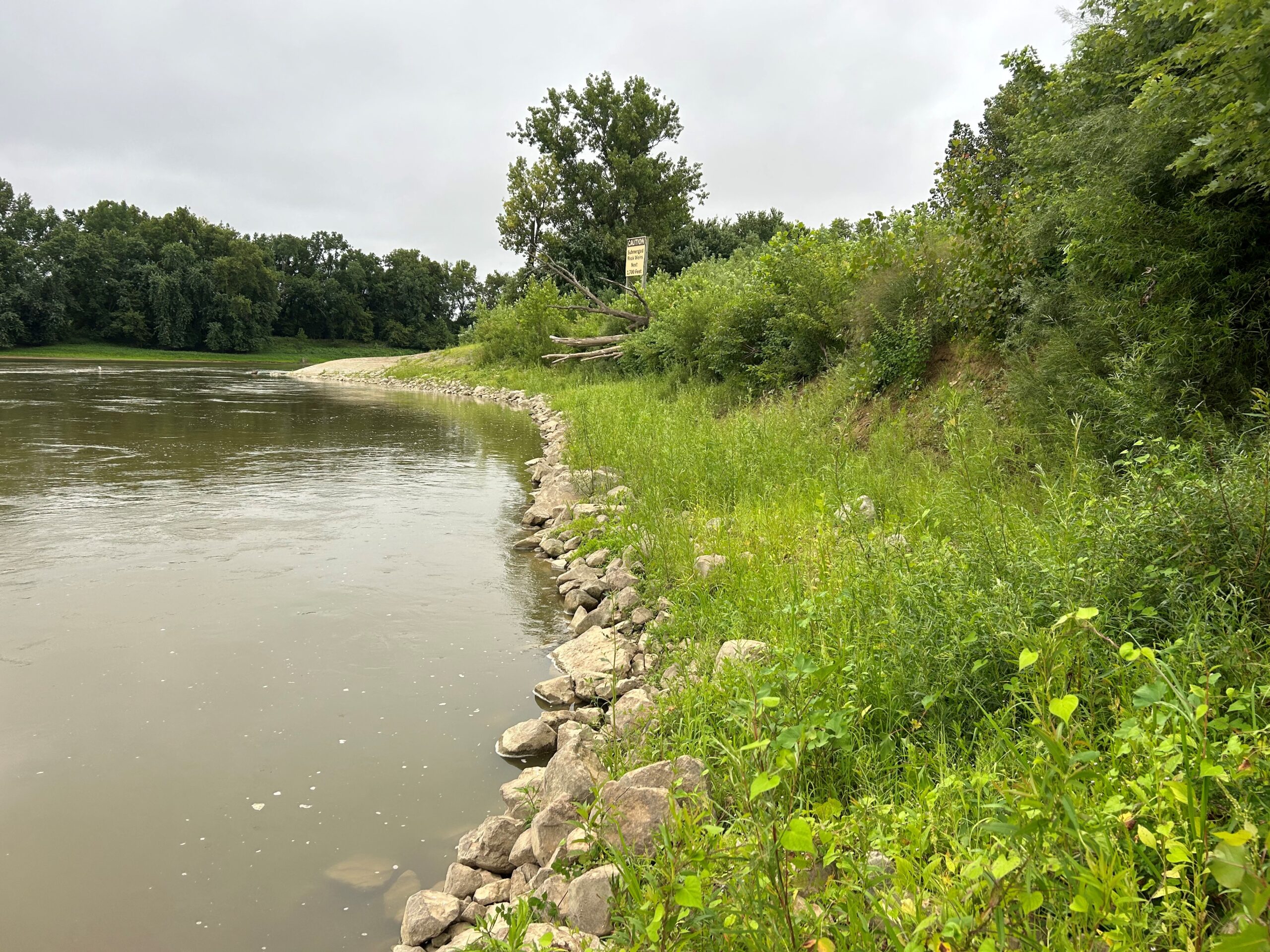
A 22-inch diameter natural gas pipeline that crosses the northwest branch of the Anacostia River in Silver Spring, MD, had become exposed due to bank erosion and lateral migration of the channel. Previously placed rock failed to remediate the erosion issue.
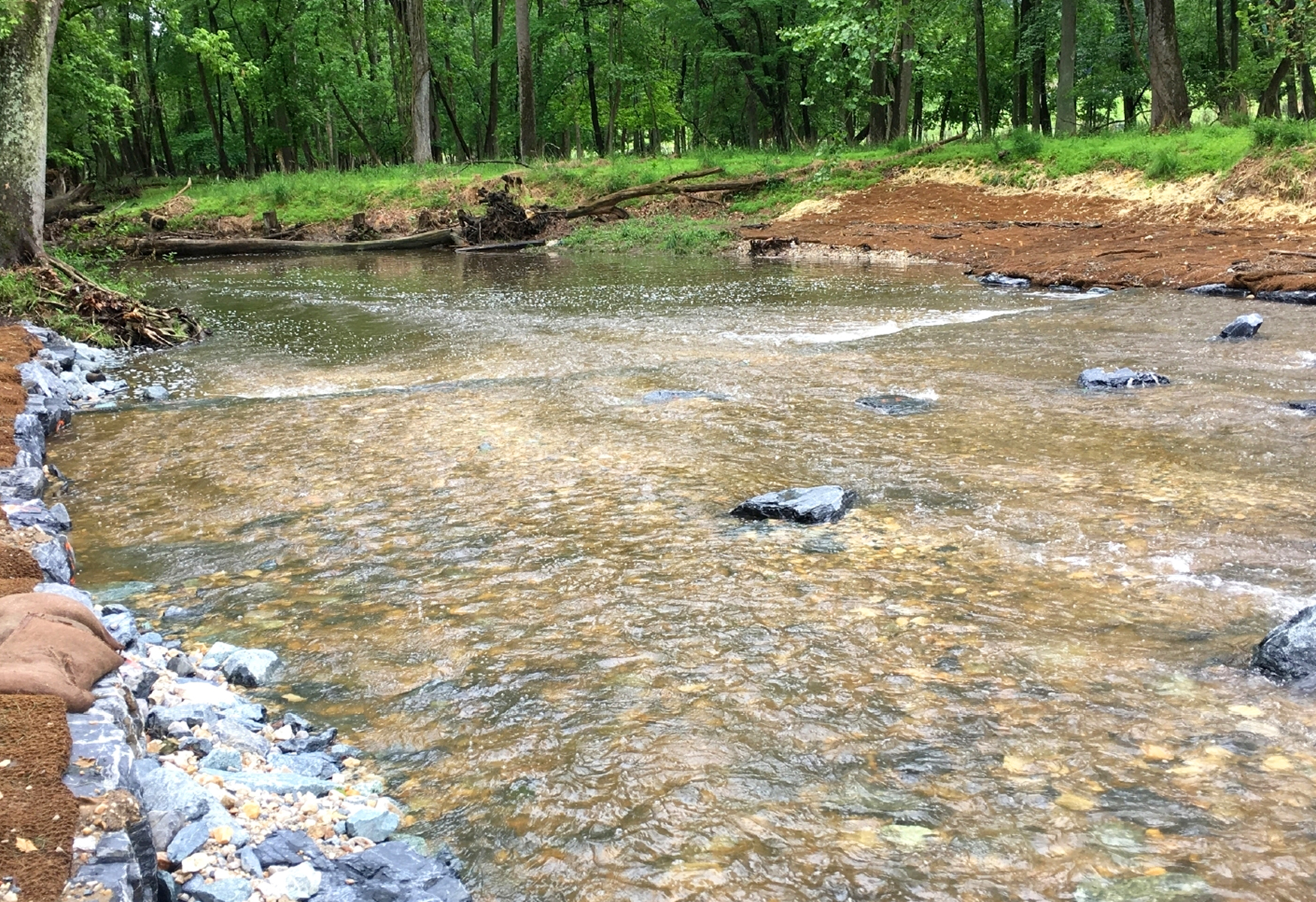
An 8-inch natural gas pipeline crosses Caddo Creek in Carter County, Oklahoma. The bed and banks of the creek are composed of clay and sand and the banks are well vegetated. Heavy rain caused lateral migration and head cutting that eroded the right descending bank.
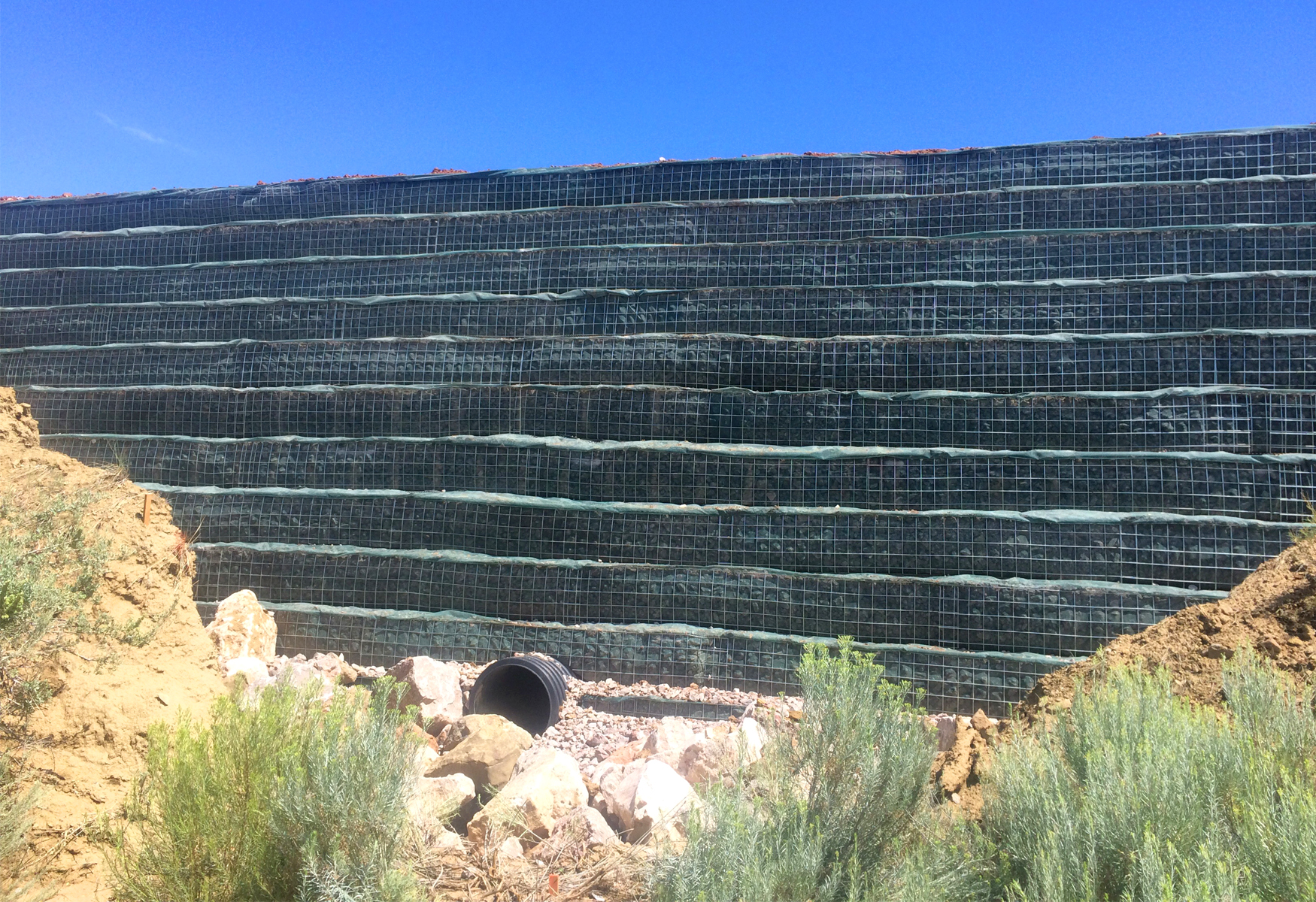
A 50-foot-wide pipeline right-of-way (ROW) had one 16-inch diameter natural gas pipeline in Lea County, New Mexico. Two sites, located 400 yards apart on the same pipeline, were being eroded directly over the pipeline ROW trench. Water running along the trench...

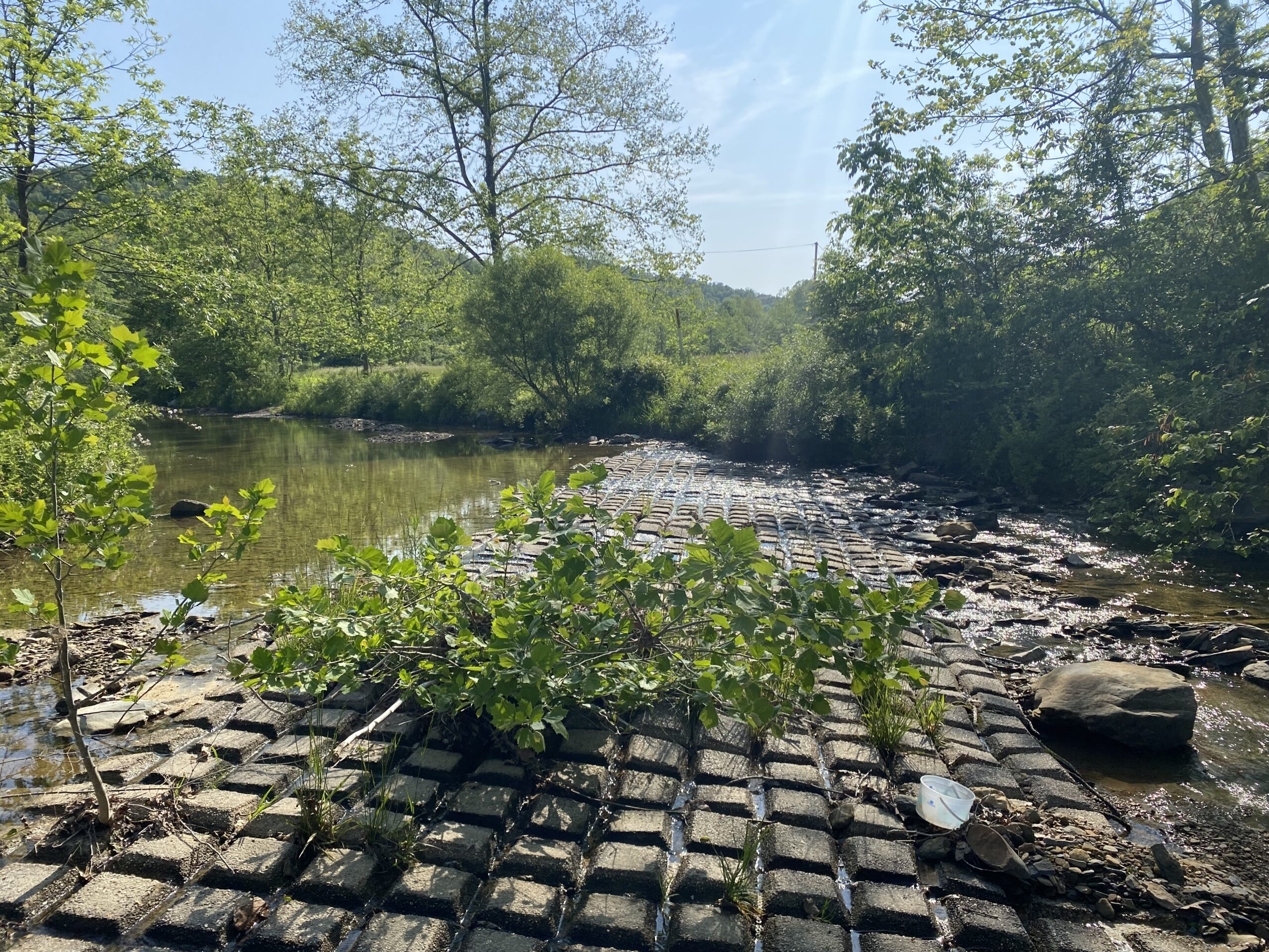
Holly Creek crosses a 30” gas transmission pipeline at nearly a 45° angle. The pipeline has a concrete cap poured on top to provide cover. The creek bed has degraded downstream of the pipeline, and the pipeline is exposed along the left bank.
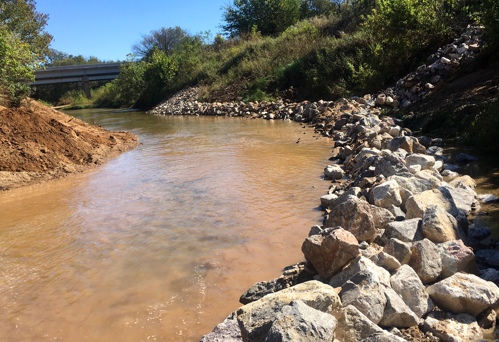
A 30-inch diameter natural gas transmission pipeline crosses at the confluence of the White River and the East Fork of the White River. The White River had laterally migrated and the right, descending, high bank eroded to expose the pipeline.

Caitlin Stroud2025-12-22T22:35:42+00:00
Merry Christmas!
Caitlin Stroud2025-12-22T22:35:42+00:00December 25th, 2025|