A 50-foot wide pipeline right-of-way contained one 8-inch diameter pipeline inside of a 10-inch casing. The pipeline was exposed across the entire 130-foot Mad River crossing in Montgomery County, Ohio. The pipeline was also suspended over a 5-foot deep by 30-foot long scour hole.
Seven pipelines crossing Lake Sakakawea in McKenzie & Williams Counties, North Dakota, experienced exposures, low depth of cover, and shoreline erosion. A multibeam bathymetry and magnetometer survey of the pipeline was completed to identify topographic features...
A 14-inch products pipeline runs parallel to an interstate in San Bernardino County, California. A nearby river has meandered towards the pipeline. Significant rainfall and run-off water have eroded the bank and undercut the pipeline, leaving the line exposed for 60 feet at a height of 17 feet.
In a tributary to West Fork San Jacinto River in Montgomery County, Texas, four pipelines owned by multiple operators were exposed following multiple rain events, including a severe 10-inch rainfall that caused lateral migration and extreme headcutting across the ROW.

An 8-inch natural gas pipeline crosses an unnamed creek in Tioga County, Pennsylvania in a 50-foot wide right-of-way. The creek bed and banks are composed of clay and rock. The right descending bank of the creek has been eroded due to flooding creating an 8-foot pipeline exposure.
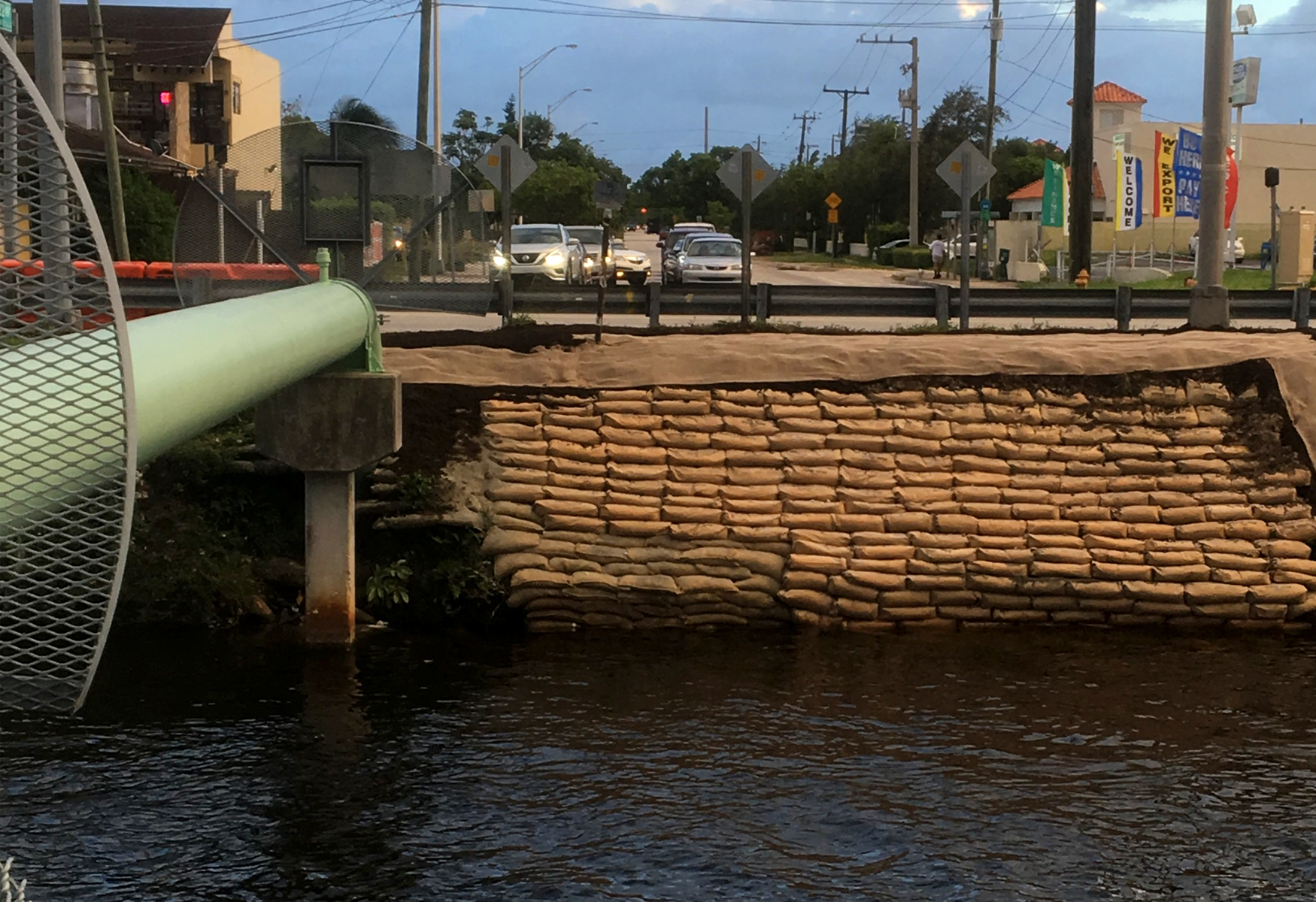
A 6-inch diameter natural gas pipeline crosses a canal in Miami, Florida. Sheet flow from the adjacent street and high flow events had exposed the pipeline. 3-in-1 concrete bags had been placed atop the pipeline in an effort to protect it, but the sheet flow and high flow events...
A 50-foot-wide pipeline right-of-way (ROW) had one 16-inch diameter natural gas pipeline in Lea County, New Mexico. Two sites, located 400 yards apart on the same pipeline, were being eroded directly over the pipeline ROW trench. Water running along the trench...
THE exposed Pipeline Remediation Experts
Submar is the leader in pipeline erosion control and remediation solutions, specializing in protecting onshore and offshore pipelines from environmental challenges.
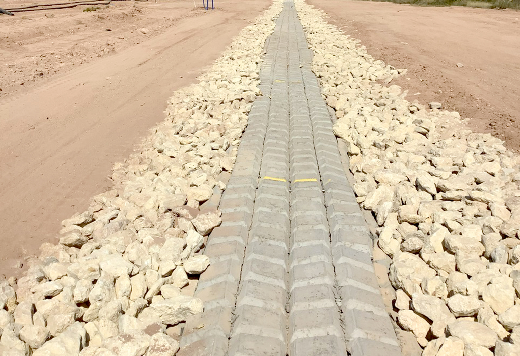
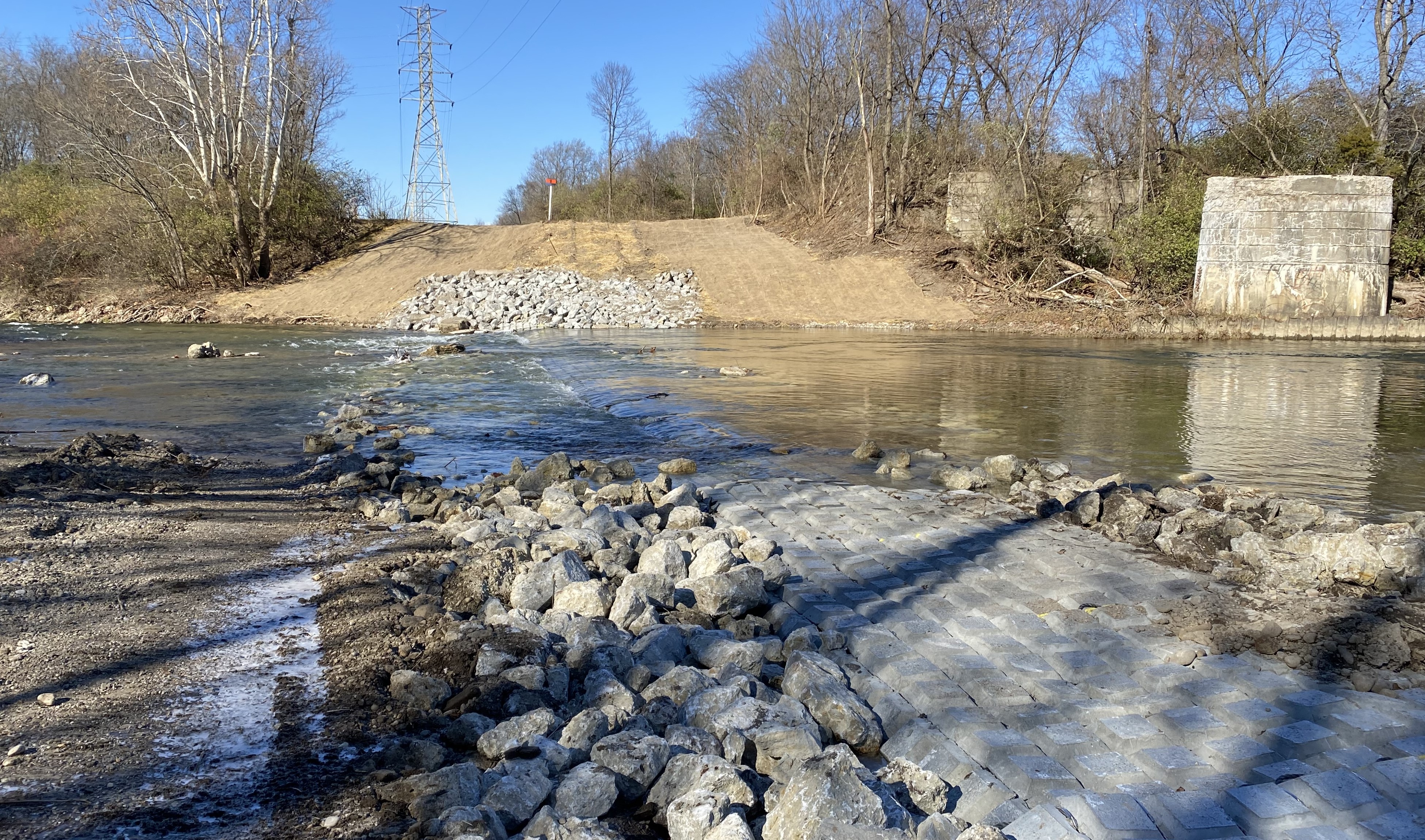
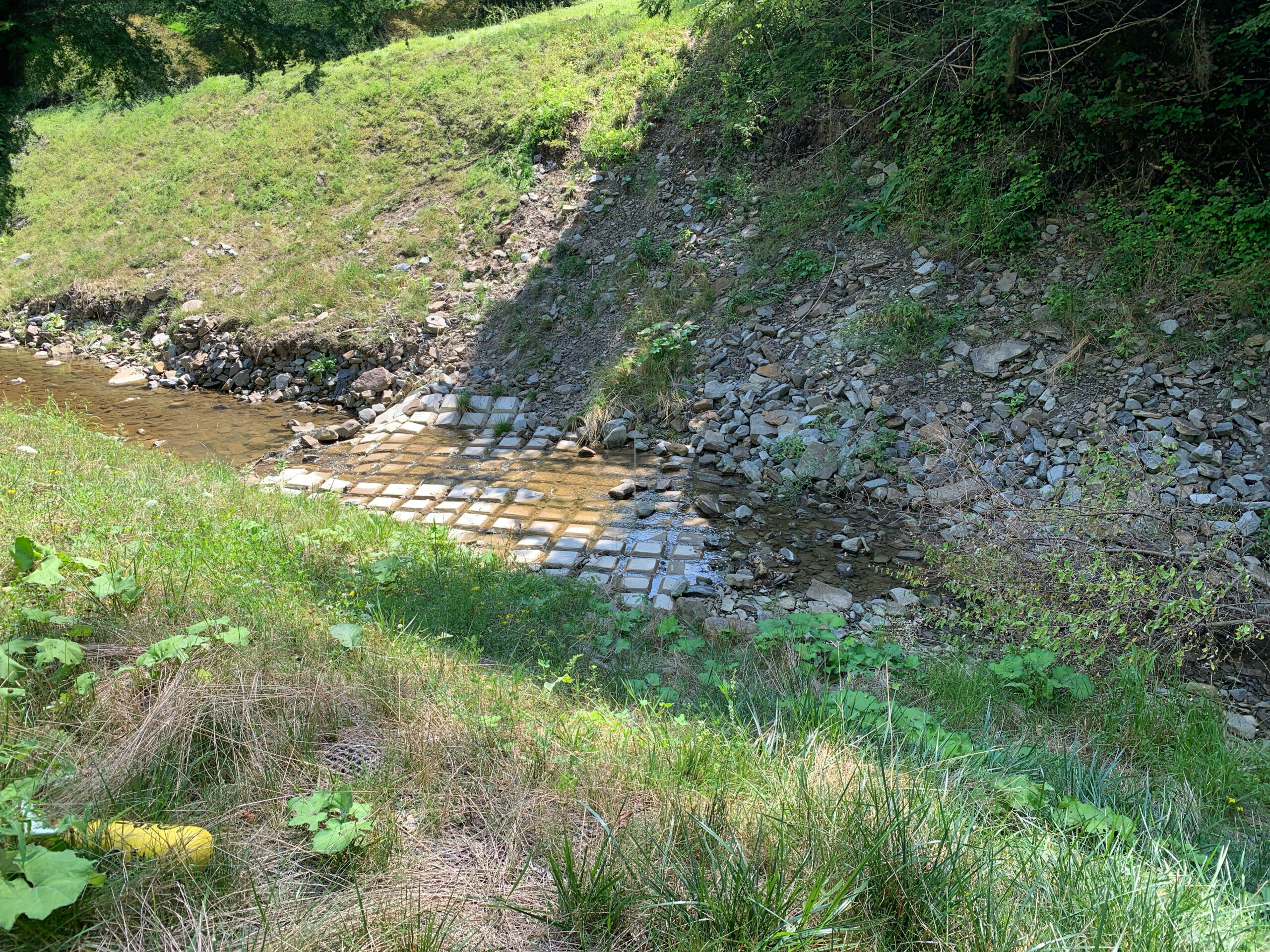
We are renowned for our articulated concrete revetment mats, which are designed to protect pipelines from erosion in a variety of environments, including subsea locations, riverbeds, and arid regions.